The collaborators--from the University of California Riverside, Arizona State University, and the Lyndon B. Johnson Space Center--sought to answer 4 major questions. First, how much does the presence of vegetation impact temperatures in Phoenix, and how does this vary over time? Second, how much water is needed for upkeep of vegetation across the city? Third, how could water requirements change if different vegetation management plans were implemented? Fourth, what is the relationship between the presence and cost of vegetation and the economic status of the neighborhoods in which the plants are growing?

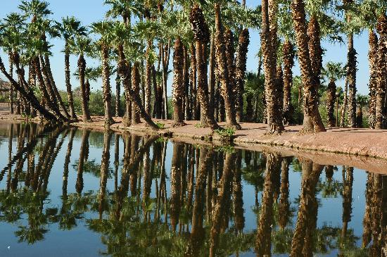
(Palm trees and other vegetation pepper downtown Phoenix, Arizona)
Data for the study were collected from a diverse array of sources and represent 4 snapshots of Phoenix--one per decade from 1970-2000. Vegetation and surface temperature indices were calculated using remotely sensed imagery. Meteorological conditions, in particular daily maximum temperature and minimum relative humidity, were assessed using measurements from a nearby weather station; these values allowed the authors to estimate the amount of cooling achieved by urban plants, as well as the hydrological costs associated with those ecosystem services. Finally, the researchers used U.S. census data to evaluate socioeconomic patterns across the city.
Prior to the study, the authors knew some basic information about heat and vegetation in Phoenix: During both the day and night, the city is warmer than the surrounding countryside; this is particularly true for the center of Phoenix where there are lower levels of vegetation, poorer neighborhoods, and high proportions of minorities. Furthermore, the city is predominantly vegetated by trees and shrubs from a "global species pool" and an equally diverse collection of turf species.

(Phoenix, Arizona--"America's sunniest metropolis." All that sunshine on impervious surfaces leads to warmer temperatures in the city than in the surrounding countryside, both at night and during the day.)
The current study paints conditions in the city with a much finer brush. The researchers found that, in both 1990 and 2000, the relationship between vegetation and surface temperature was strongest during the summer and weakest during the winter. Surface temperature, of course, was related to air temperature: Air temperatures between 15 and 45 degrees corresponded to surface temperatures between 20 and 63 degrees. The cooling effect of vegetation was impacted by the "vapor pressure deficit," which describes the difference between how much moisture is already in the air and how much it is capable of holding overall; this is impacted by both relative humidity and air temperature. Over the range of these 2 variables, vegetation was capable of reducing surface temperature anywhere from 1 to 25 degrees Celsius.
Across the study area, there were substantial variations in water flux throughout the day. Interestingly, water requirements were higher in neighborhoods where median income was higher. This was related to greater amounts of vegetation in these areas; the presence of the plants was also associated with cooler temperatures. Additionally, "refugia"--places with a surface temperature below 50 degrees Celsius--were more common in areas with higher median household income. This has not always been true; the strength of the relationship between vegetation and income increased drastically between 1970 and 2000, indicating that vegetation has gradually become more common in wealthier areas, but less common in poorer areas. Unfortunately, the researchers' models indicate that vast amounts of water could be required to reduce inequalities between neighborhoods. The exact amounts needed would vary among neighborhoods, and depend on the difference between current and desired amounts of vegetation and the potential layout of the landscape.

(NASA heat map of Phoenix, Arizona in July, 2000. Soil and pervious surface are shown in red, vegetation is shown in green, and impervious surface is shown in blue. The image was featured as part of NASA's write-up of the study discussed in this post.)
Overall, the results from the study indicate that vegetation in Phoenix provides an important ecosystem service--reducing bare surface temperatures during the summer, when heat-related health hazards are particularly problematic. Unfortunately, the benefit of the plants comes at a high cost, in terms of water flux. Water usage in Phoenix was similar to that observed in the riparian forests and grasslands of southern Arizona, rather than that found elsewhere in the neighboring Sonoran Desert. These levels of water consumption are associated with a number of economic and environmental expenses, and may siphon water away from other plants that need it--such as those in nearby agricultural fields.
The socioeconomic findings of the current study are, sadly, in agreement with those reported elsewhere. Because of the relationships between environmental inequalities and spatial segregation, lower-income residents are especially susceptible to extreme heat, the effects of which may be compounded by other unfavorable conditions found in poorer neighborhoods (including bad air quality and proximity to contaminated areas). This was not true during the earlier years of the study, but has become problematic only over the past couple of decades.
(Native desert vegetation in Papago Park at the Desert Botanical Garden in Phoenix, Arizona)
Although it is tempting to assume that widespread tree-planting initiatives--which have become increasingly popular across the U.S.--can be used as a "quick fix"to improve urban environmental conditions, the authors stress that the best landscape management practices are those that are multifaceted. Thus, it is important to consider not only vegetation, but also social support services, housing quality, extreme weather warning services, and emergency response plans. Over the long run, government agencies may need to reconsider the distribution of tax funds associated with heat management-related projects.
The authors stress that their current models are only a beginning; with additional refinements, they can be used to look for additional relationships and develop more accurate estimates. For this to happen, it will be important to better understand particular terms in the model, such as "surface heat capacity," "boundary layer conductance," "albedo," "heat storage," and "net radiation." Additionally, future models could be made even more accurate through the use of 3D technology.
---
For supplementary images related to this post, please check out the Anthrophysis board at Pinterest.
Jenerette, G.D., Harlan, S.L., Stefanov, W.L., and Martin, C.A. 2011. Ecosystem services and urban heat riskscape moderation: water, green spaces, and social inequality in Phoenix, USA. Ecological Applications 21(7):2637-2651.
Thanks to the following websites for providing the images used in this post:
http://www.phoenixhomebuyerguide.com/about-phoenix/
http://www.pixelchrome.com/blog/?p=939
http://www.nasa.gov/topics/earth/features/phoenix_heatwaves_feature.html
http://www.tripadvisor.com/Attraction_Review-g31310-d109186-Reviews-Desert_Botanical_Garden-Phoenix_Arizona.html
No comments:
Post a Comment